Salem Center Presbyterian Church – Map Location 4
Salem Center Presbyterian Church Map Location 4 Originally a Methodist church, the Salem Center Presbyterian Church was built in 1867. In the 1920’s the building was sold to the Presbyterians and they still worship there today. View Map Location Address 3935...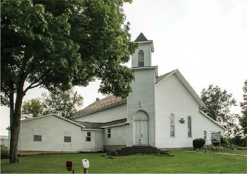
Ray Community Church – Map Location 10
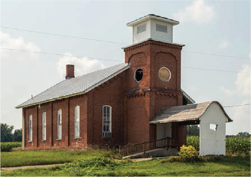
Ray Community Church Map Location 10 Formerly the Cedar Lake Reformed Presbyterian Church (Covenanters), it was built in 1876 and used by the Covenanters for 50 years. View Map Location Address 6265 E. 800 N. Fremont Telephone 260-495-0086 Historical...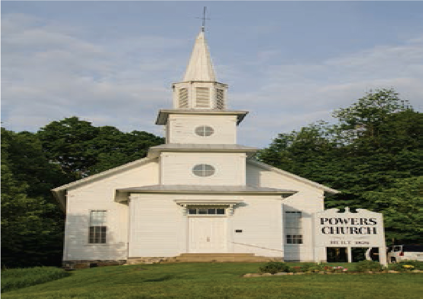
Powers Church – Map Location 13
Powers Church Map Location 13 Powers Church was built during the summer of 1876 as a free church and was nondenominational. Regular services ceased in the 1920’s. It was added to the National Register of Historic Places in 1983. View Map Location Address 1 N....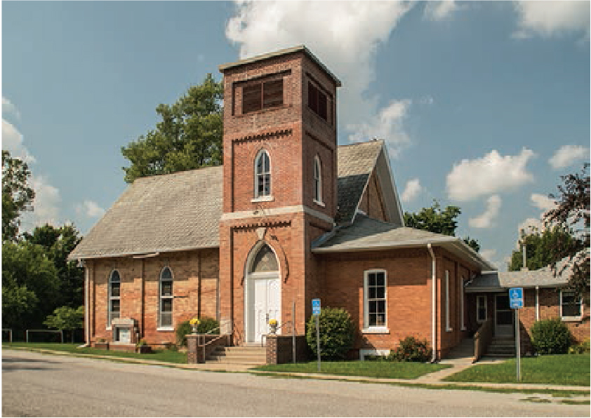
Pleasant Lake Baptist Church – Map Location 1
Pleasant Lake Baptist Church Map Location 1 The church was built in 1880. A brick structure, it forms the main part of today’s church. It has always been a Baptist church. View Map Location Address 1380 W. State St. Pleasant Lake Telephone...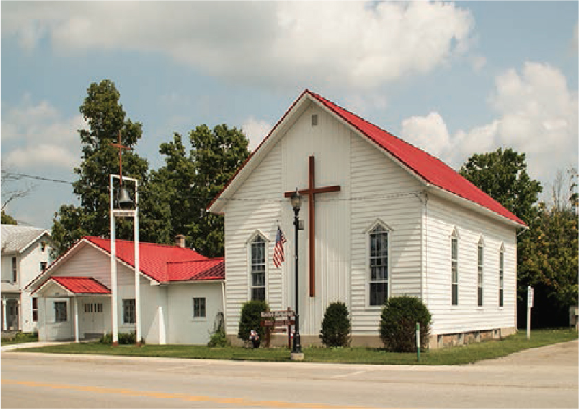
Orland United Methodist Church – Map Location 8
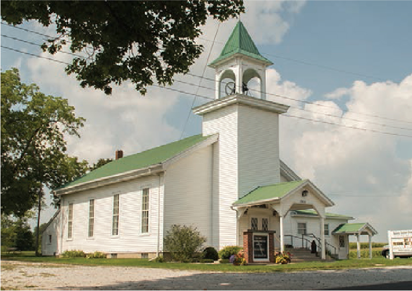
Orland United Methodist Church Map Location 8 The Orland United Methodist Church was built in 1878. It was fashioned after the old white churches of the early settlers’ fathers. View Map Location Address 6150 N. St. Rd. 327 Orland Telephone...Steuben County
![]() With more than 101 natural lakes and Indiana’s most beautiful state park, Steuben County is a recreational wonderland. Pokagon State Park, on the banks of Lake James, has the state’s only toboggan slide as well as hiking and biking trails, guided horseback rides, boat rentals and the historic Potawatomi Inn. Tour the 200-acre buffalo preserve, visit our winery and discover unique downtowns and restaurants throughout Steuben County.
With more than 101 natural lakes and Indiana’s most beautiful state park, Steuben County is a recreational wonderland. Pokagon State Park, on the banks of Lake James, has the state’s only toboggan slide as well as hiking and biking trails, guided horseback rides, boat rentals and the historic Potawatomi Inn. Tour the 200-acre buffalo preserve, visit our winery and discover unique downtowns and restaurants throughout Steuben County.